By Agnieszka Gautier
The Ganges, a sacred river with over a hundred names, drops over 14,000 feet from the terminus of the Gangotri Glacier in the Himalayas before it barrels into the Bay of Bengal, some 1,550 miles later. It is one of many rivers originating in the Himalayas that collectively support about 1.5 billion people, providing drinking water, irrigation, and hydropower. Precipitation in the form of rain and snow plus glacier melt feed five regional river basins that include Nepal, Bhutan, India, Pakistan, Kyrgyzstan, Tajikistan, Kazakhstan, and Afghanistan.
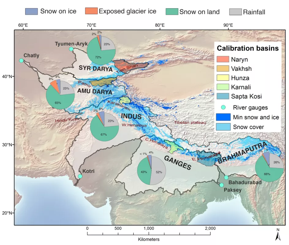
Approximately 15,000 glaciers cover High Asia, the Asia of the Himalayan, Karakoram, Hindu Kush, Pamir, and Tien Shan mountain ranges (see map below). Lower-elevation Himalayan glaciers are receding, but are the higher-elevation glaciers? And if these glaciers disappeared, would there be enough snow and rain to feed hydropower projects and to quench the lands and its people? “This is when I thought a good literature search would solve this problem,” said Richard Armstrong, a research scientist at the National Snow and Ice Data Center (NSIDC) at the University of Colorado Boulder. However, there had been no systematic assessment of the origins of water across the region—whether from seasonal snow melt, glacier ice melt, or rainfall.
The United States Agency for International Development (USAID) also wanted answers. In 2012, they funded the University of Colorado Boulder, the first time the agency directly funded a university, to support the Contribution to High Asia Runoff from Ice and Snow, or CHARIS project. Half of the funding would go directly to scientific research at NSIDC while the other half would support infrastructural development and Asian research.
Into High Asia
Not enough data exist on river flows and the contribution of seasonal snow and glacier melt to paint an accurate picture of the water sources. “We can’t predict future conditions until we better understand the current conditions,” Armstrong said. Limited resources and extreme terrain exacerbate field monitoring in the Himalayas. Consequently, research in High Asia relies heavily on satellite remote sensing, with pockets of ground-based data for validation.
Basic needs also stifle field research across much of High Asia. For instance, CHARIS purchased boots and other mountaineering gear for Afghan researchers so the group could start their field measurements in 2018. “It’s that extreme,” Armstrong said. “We’re dealing with both well-funded institutions along with researchers who need our money to put gas in their trucks.”
All these challenges were addressed through the coordination efforts of eleven partnerships with institutions in eight countries. Together, the teams studied and quantified water sources for five river basins: Indus, Ganges, Brahmaputra, Syr Darya, and Amu Darya.
The results are in
Using the Moderate Resolution Imaging Spectroradiometer (MODIS) sensor, the team produced gridded maps of glacierized areas and seasonal snow cover stretching back to the year 2001. Then these data were placed into a temperature index model to assess the volume of melting.
The model results show that High Asia has two sides to its water story: strong reliance on snow and glacier melt versus the dominance of the monsoons. In western High Asia, about 15 to 20 percent of water flows in from glacial ice melt, which consistently occurs during June, July, and August. This period coincides with the maximum monsoon rainfall in eastern High Asia, where contribution of water from glacial melt is less than 5 percent. And in general, snowmelt contributes ten times more water than glacier ice melt across the region. In contrast to low-elevation glacier retreat, seasonal snow cover has not decreased significantly over the last 15 years.
High Asia is not alone in facing the challenge of rooting out water sources. “Even in Switzerland, where glaciers are well scrutinized, most modeling lumps snow melt and glacial melt together,” Armstrong said. So the modeling CHARIS has accomplished could now be applied to other mountain ranges.
Just the beginning
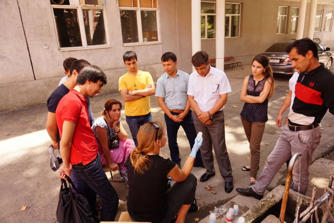
The CHARIS project ends in September 2018. Since 2012, Armstrong and his team organized ten international training workshops, held in different countries in Asia, funded the restoration of a glacier research hut in Kyrgyzstan, and helped build a state of the art water chemistry lab in Bhutan, which previously had no labs to test water quality.
With more understanding of how these rivers flow, it is now a matter of water management. “In many locations in High Asia there is insufficient water storage,” Armstrong said. Right now, rivers flow freely, moving from one elevation down to the next for the next group of people to use. “But if it comes to a point where there is less and less glacier melt, or earlier seasonal snow melt, then in many locations they will need to capture the melt water in spring and early summer to use later in the growing season—to store in a reservoir like we do in Colorado,” Armstrong said.
“Without this project, the probability that these individual partners across the eleven institutions would have met would have been low,” Armstrong said. “And the reality is that they are all working on the same problem. These regions are connected through water. To have channels in place to communicate is a major step forward. As scientists they are crossing boundaries.”
CHARIS partners
Nepal, Kathmandu University
Afghanistan, Kabul University
Bhutan, National Center for Hydrology and Meteorology
Bhutan, Sherubtse College, Royal University of Bhutan
India, Jawaharlal Nehru University
India, Sharda University
Kazakhstan, Institute of Geography
Kyrgyz Republic, Institute of Water Problems and Hydropower
Pakistan, Karakoram International University
Pakistan, Water and Power Development Authority WAPDA
Tajikistan, Institute of Water Problems, Hydropower, Ecology
For more information
USAID, CU-Boulder partner to study water resources in Asia mountains
CHARIS project at NSIDC


