Images of Antarctic Ice Shelves
Pine Island Bay
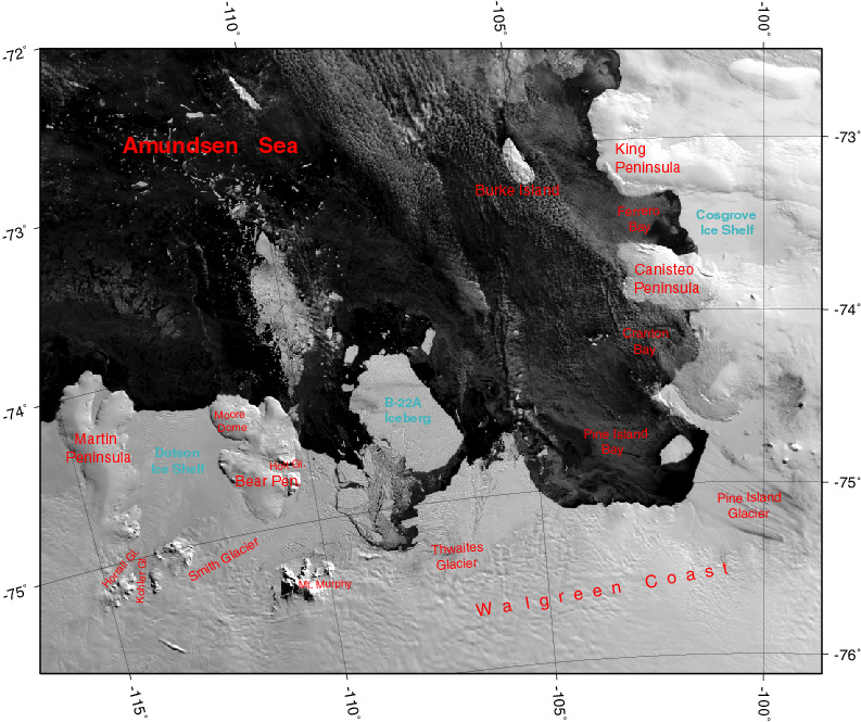
Location Map: MODIS image from 12 March 2003, 16:15
To download a grid/placename overlay like the one in the above image, click here.
Select another ice shelf
Projection Information
Projection: Polar Stereographic
Datum: WGS84
Standard Parallel: -70.0
Corner Coordinates:
UL: 71.998860S 113.594373W
LL: 75.491196S 117.004071W
UR: 72.492200S 98.868027W
LR: 76.115095S 98.568614W
Number of Rows (MODIS): 1600
Number of Columns (MODIS): 2000
Number of Rows (AVHRR): 800
Number of Columns (AVHRR): 1000
Meters per Pixel (MODIS): 250
Meters per Pixel (AVHRR): 500
Additional Pine Island imagery Images from various instruments highlighting special events or features of the iceshelf.

