By Agnieszka Gautier
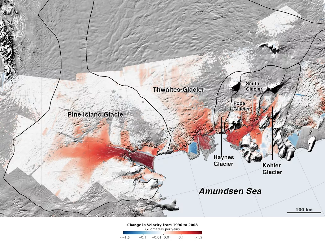
The broad tongue of Thwaites Glacier spreads its ice onto the cold Amundsen Sea, forming a floating ice shelf. But warm waters and stronger winds are loosening the glacier’s hold on the continent. Although the Amundsen Sea glaciers make up only a fraction of the whole West Antarctic Ice Sheet (WAIS), the region contains enough ice to raise global sea levels by 1.2 meters (4 feet).
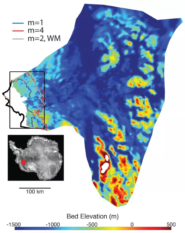
Massive portions of the WAIS dip below sea level. In theory, this inland slope inherently destabilizes the ice sheet and may lead to rapid disintegration. NSIDC scientist Ted Scambos thinks that Thwaites Glacier—having the deepest ice at the center of the WAIS—is particularly vulnerable to a runaway, when a glacier lifts off the continent and slides into the ocean.
X-ray vision
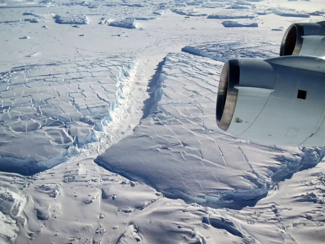
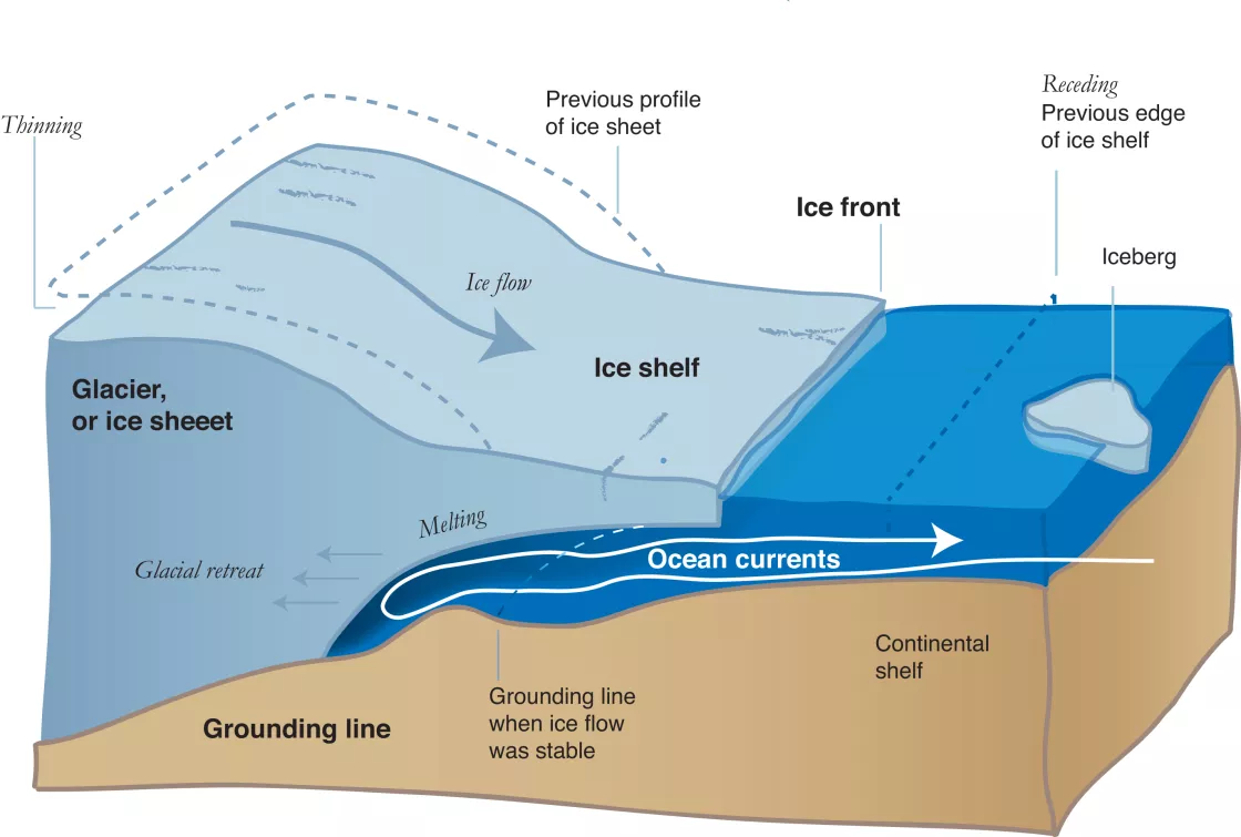
NASA Operation IceBridge and other missions have pierced through Antarctica’s two-mile thick ice, to unveil its bedrock topography where extensive sections drop up to a mile and a half below sea level. Warming waters grind away at the ice along its grounding lines, where ice flows off the continent and begins to float. “You really chew away at the ice here,” Scambos said. “The rate of melting can be 100 feet per year. So this destabilizes the contact area.” If the ice shelf thins enough, inland ice may begin to float, allowing warm water into the new gap, easing friction against the continent. “Then the glacier could lift off,” Scambos said. “And this whole ice section of ice, the size of Colorado, could runaway very quickly. Once it gets past a certain point, there’s a positive feedback and it gets out of control. At that point, it can’t be stopped.” For now, the floating ice sheet dams inland glaciers. Still, the big ice mass that is piled on top of the continent wants to push out toward the ocean.
How did we get here?
Climate change is impacting Antarctica on many levels: on the ice, in the ocean, and on the winds driving the ocean. Warmer temperatures in the ocean’s middle layers are part of the concern, but a bigger issue is shifting winds that have occurred in the past 40 years. These winds are driving deep ocean layers onto the continental shelf. The warm water pulses—which have been around, but never with this much frequency—weaken the brakes from the ice shelves since their underbelly gets eaten away.
Faster winds circling the continent push deeper warm waters toward the coast in the Amundsen Sea. As a huge, high continent that sticks out, Antarctica stabilizes the circular, westerly-wind pattern. As the mid-latitudes get warmer, the winds get squeezed against this immoveable land mass. The bottleneck-effect strengthens winds on average, pushing surface water outward and turning the deep, warm ocean layer inward. “It used to happen before climate warming kicked off,” Scambos said, “but now happens more often. It’s changing the continent’s stability.” Not every glacier is as unstable as the Thwaites Glacier, but even on its own, Thwaites is a major factor in future change scenarios. If Thwaites melted, it would change the dynamics of the entire region. “When the Thwaites Glacier changes, it won’t happen in isolation,” Scambos said. Though the entire ice sheet may not immediately run away, the impact would disperse, and if the entire WAIS followed a similar demise, sea levels would rise 3 to 4 meters (10 to 13 feet).
Humpty dumpty
Melting is expected to increase as climate change progresses. Still, it will take centuries for the gigantic Thwaites ice mass to melt away. However, a new factor threatens faster deterioration. Rather than a gradual lift off, grounding lines could thin and split off the ice shelf, forming an ice cliff. If the ice cliff reaches 90 meters (295 feet), it will topple. “This is something so simple I can’t believe we missed it for so long,” Scambos said. “Ice is just not strong enough to support a cliff more than 300 feet tall.”
It has happened before. In 2008, Jakobshavn, Greenland—the largest glacier on Earth’s second largest ice sheet—an ice cliff formed when glaciers retreated. Since then, the ice cliff repeatedly peels off. So this huge glacier has retreated twelve miles in fifteen years. As soon as a new cliff is exposed, cracks form on top and the glacier almost continuously calves away, crumbling quickly. If this scenario unfolds on the Antarctic Ice Sheet, it would mean Thwaites Glacier could deteriorate much sooner, possibly in as little as 50 to 100 years. “It’s not clear how this would happen,” Scambos said. “We haven’t seen basal melting to the point where an ice shelf just falls apart. We haven’t seen this play out in West Antarctica yet.” Thwaites is only one element of suspense surrounding ice decline in the WAIS, where mass loss increased by 75 percent from 1996 to 2006. In 2014, with warming waters and stronger winds around Antarctica, several studies concluded the inevitable decline of West Antarctic glaciers. Scambos recently published a briefing discussing Antarctic mass loss and future sea level rise, including the potential demise of Thwaites. He said, “Our summary paper advertises and underscores the results from several papers.” Read it here.
References
Joughin, I., B. E. Smith, and B. Medley. 2014. Marine ice sheet collapse potentially under way for the Thwaites Glacier Basin, West Antarctica. Science 344, 735. DOI: 10.1126/science.1249055
Scambos, T. and J. Abraham. 2014. Briefing: Antarctic ice sheet mass loss and future sea-level rise. Proceedings of the ICE-Forensic Engineering, Vol. 168, Issue 2, 81-84. DOI: 10.1680/feng.14.00014.
Rignot, E., J. L. Bamber, M. R. van den Broeke, C. H. Davis, Y. Li, and W. J. van de Berg. 2008. Recent Antarctic ice mass loss from radar interferometry and regional climate modeling. Nature Geoscience. 1(2): 106-110. DOI: 10.1038/ngeo102


